El-Sheikh Fadl and al-Qays
This area was an important part of the 17th Upper Egyptian nome in Pharaonic times because its nome capital, ancient Saka, Henu, Input, Hardai or Kynopolis, as the city was variably called, is most probably located here. It was also home to a jackal cult, where the god Anubis had a major sanctuary. Although the relationship between these cities and their identification with the archaeological sites are yet to be ascertained, it is possible to state that the area once must have provided space for a fairly large urban community which resided in the city underneath the village of al-Qays and was buried in the nearby cemeteries of el-Sheikh Fadl (Fig. 1).
The modern village and archaeological site of el-Sheikh Fadl are located directly opposite the town of Beni Mazar. There are two main areas of interest, one being the site of Malqata at the edge of the flood plain, and the other being a large necropolis further east on a series of mountainous hills locally known as Arab Hamada or Umm Raqaba which stretches over ca. 4 km in north-western to south-eastern direction (Figs. 2). The highest peak is Gebel el-Tamarkiya in the south and rises 137 m above sea level. The necropolis comprises primarily rock-cut tombs which appear to concentrate on the valley side of the mountains. The terrain can be divided in four distinct areas which were surveyed by this mission in 2014. It is obvious that the rock-cut tombs represent a variety of different architectural designs and sizes, ranging from simple shaft tombs, small rock-cut chambers to large rooms and pillared halls carved horizontally into the slope of the hills at different levels (Figs. 3-4). The majority of tombs does not appear to be inscribed or decorated (beside large numbers of ancient and modern graffiti) and can therefore not be dated on the basis of epigraphic evidence. Due to previous work by Flinders Petrie, Jean Capart and missions of the Egyptian Antiquities Organization directed by Adel Hassan, Samir Anis, Ibrahim Zakariya, Abdel Halim M. Abdel Halim and studies by Farouk Gomaa during the 20th century, the necropolis is generally considered to date to the Graeco-Roman period, although there is evidence to suggest that its occupation goes back also into in earlier Pharaonic times. It is possible that the architectural heterogeneity of the tombs' designs may reflect different periods of occupation, but also different social strata judging by the expenditure involved in cutting these structures out of the rock. In addition, the site also served as an animal necropolis, especially for canines, but also for other animals including birds as well as possibly cat fish (Figs. 10-11). It is not obvious at this time, if some of the tombs were specifically made for animal burial or if humans and animals shared the same space.
At Malqata, at the edge of the floodplain to the west of el-Sheikh Fadl, two Egyptian missions have uncovered a relatively large cemetery (Fig. 20). According to Farouk Gomaa, this area exhibits primarily archaeological remains of the late Roman/Byzantine period. On the other side of the river, at the nearby village of al-Qays, there are two sizable kôms which would be important to examine as they may be the location of the ancient city of Kynopolis, but unfortunately both are covered by modern houses and cemeteries (Fig. 21-22).
The significance of this area has long been recognized, but many questions remain and very little has been published, because it has never been investigated systematically. Following the Egyptian revolution of 2011, the area has been subject to ongoing vandalism, modern construction and systematic looting making it necessary to engage in comprehensive site monitoring and modern standard archaeological rescue excavations in order to salvage what is left and to provide more scientific information on the periods and nature of occupation, as well as the funerary and bio-archaeology of the societies buried here. This is what the Austrian mission has been engaged with since 2014 (Figs. 5-19).
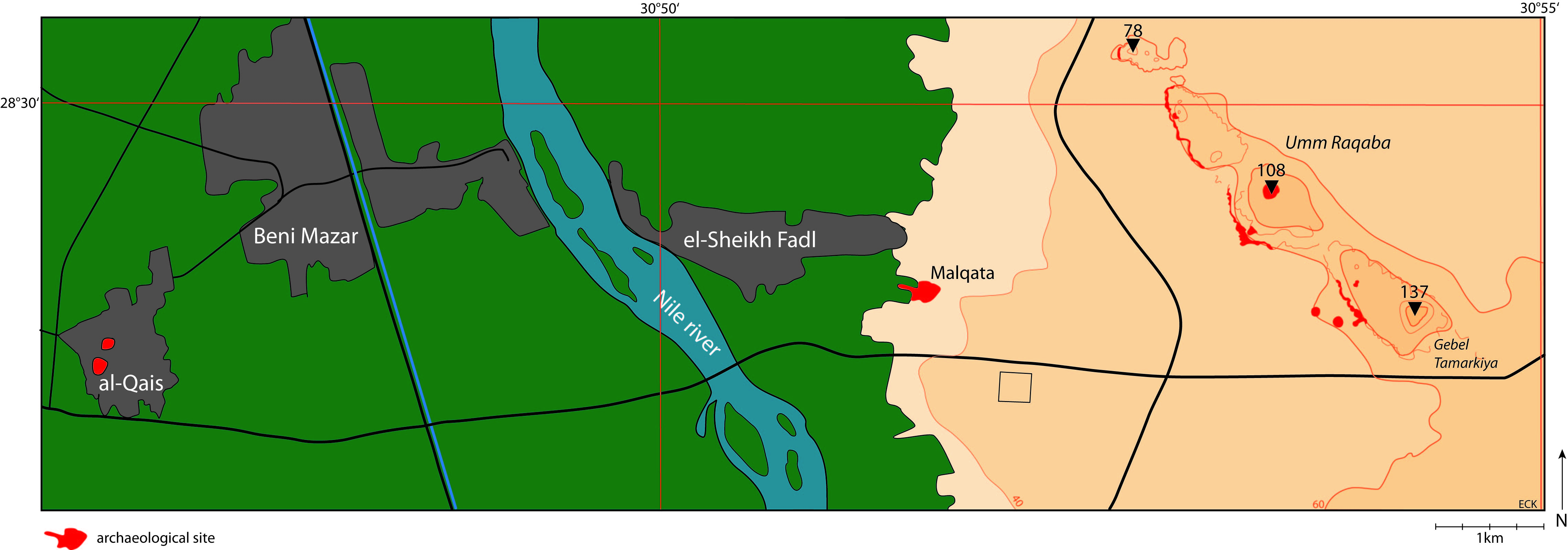
Fig. 1: Map of the area around el-Sheikh Fadl and al-Qays

Fig.2: Digital Elevation Model of el-Sheikh Fadl - Umm Raqaba looking southeast (by A. Makovics)
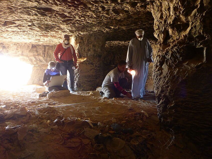
Fig. 3: Large rock-tomb at el-Sheikh Fadl in the process of being mapped by the Austrian mission
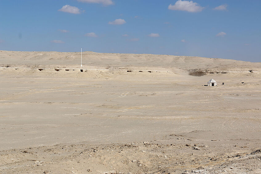
Fig. 4: Tombs in Area 4 Sector 5 and 6 at el-Sheikh Fadl. The arrow points to Tomb 2 that was excavated during the 2014 fall season
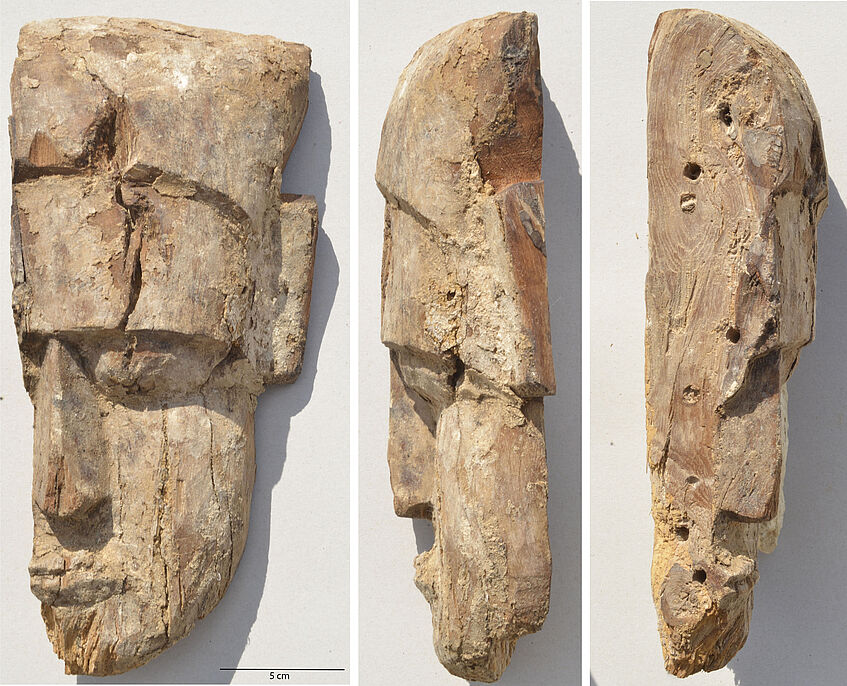
Fig. 5: Fragment of a wooden anthropomorphic coffin collected from the surface in Area 3
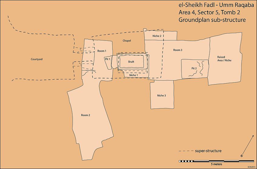
Fig. 6: Plan of Tomb 2 in Area 4 Sector 5 at el-Sheikh Fadl highlighting the two burial suites of the substructure after excavation. Based on the pottery this tomb probably dates late 5th century B.C.E.
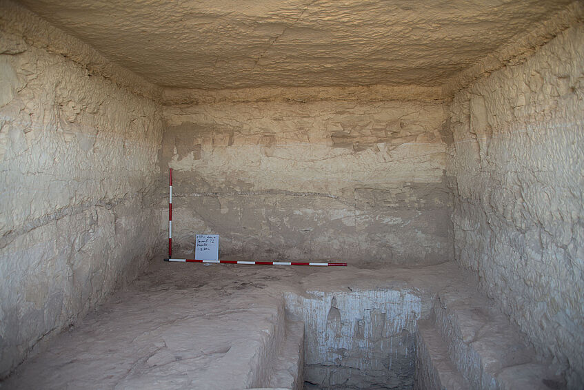
Fig. 7: The chapel and shaft of Tomb 2 in Area 4 Sector 5 at el-Sheikh Fadl looking east
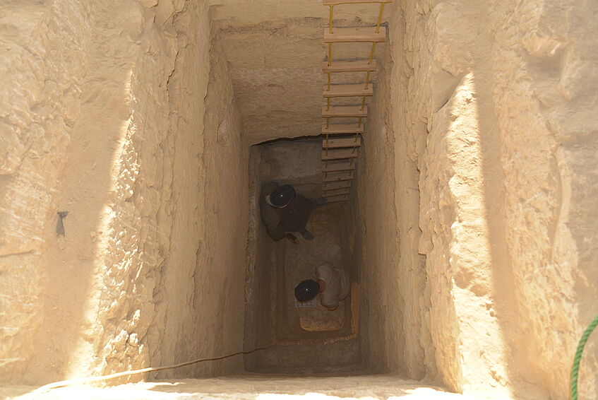
Fig. 8: Looking down the shaft of Tomb 2 in Area 4 Sector 5 at el-Sheikh Fadl
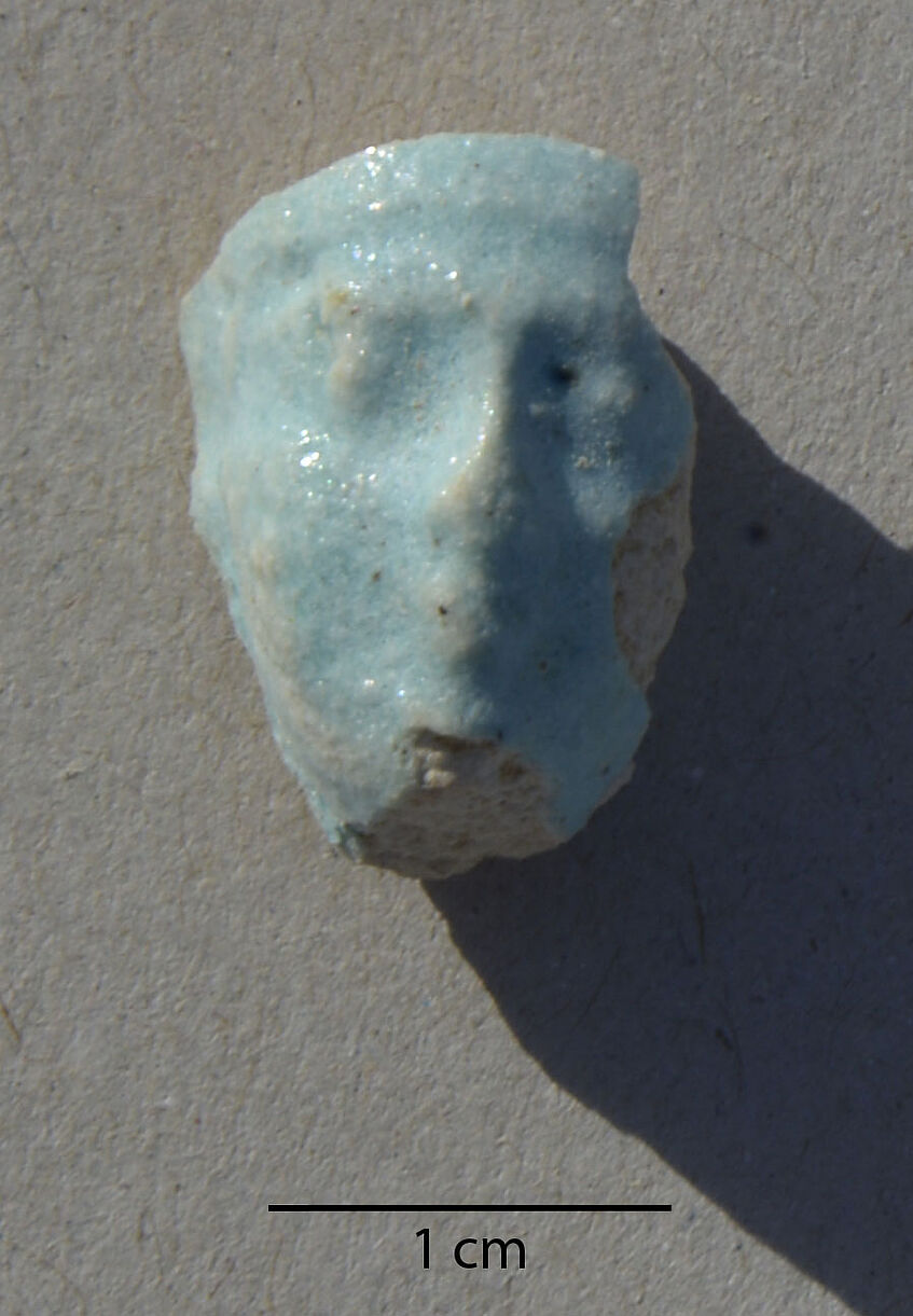
Fig. 9: Fragment of a shabty figurine made of Egyptian faience from Tomb 2 in Area 4 Sector 5 at el-Sheikh Fadl
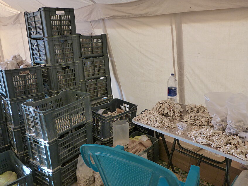
Fig. 10: Faunal remains collected during surface collections and rescue excavation at el-Sheikh Fadl
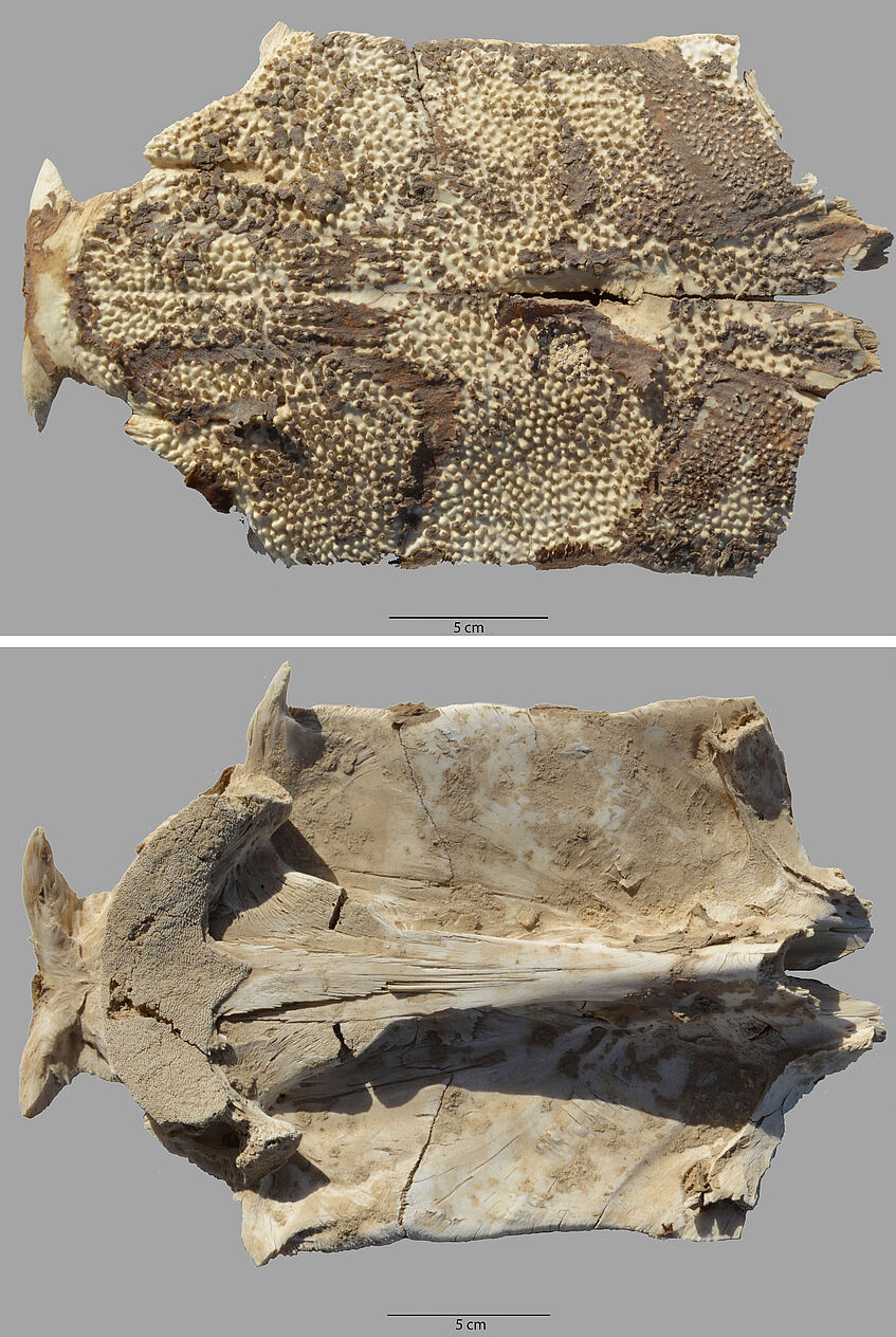
Fig. 11: Part of the skull of a giant Nile catfish collected from the surface in Area 4 at el-Sheikh Fadl
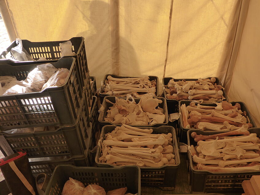
Fig. 12: Human remains collected from the surface in Area 4 at el-Sheikh Fadl
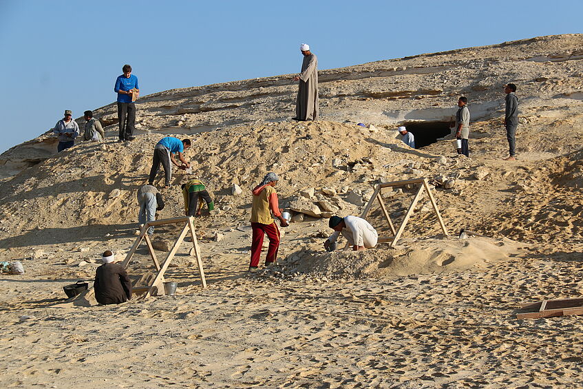
Fig. 13: Excavations by the Austrian mission in Area 4 Sector 5 at el-Sheikh Fadl
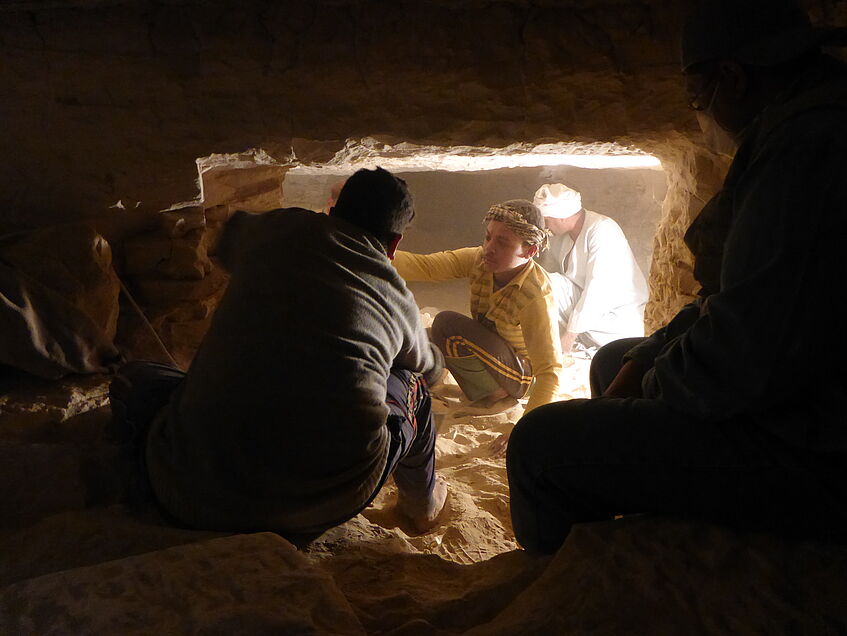
Fig. 14: Excavations in the burial chamber of Tomb 2 in Area 4 Sector 5 at el-Sheikh Fadl
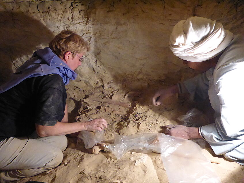
Fig. 15: Excavations in the burial chamber of Tomb 2 in Area 4 Sector 5 at el-Sheikh Fadl
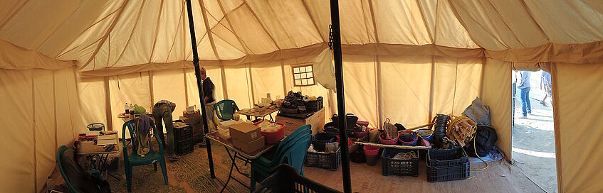
Fig. 16: Panoramic view of the work tent of the Austrian mission at el-Sheikh Fadl
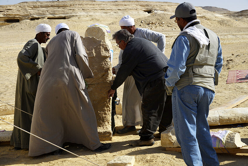
Fig. 17: Stone sarcophagi collected from the surface in Area 3 at el-Sheikh Fadl during emergency conservation
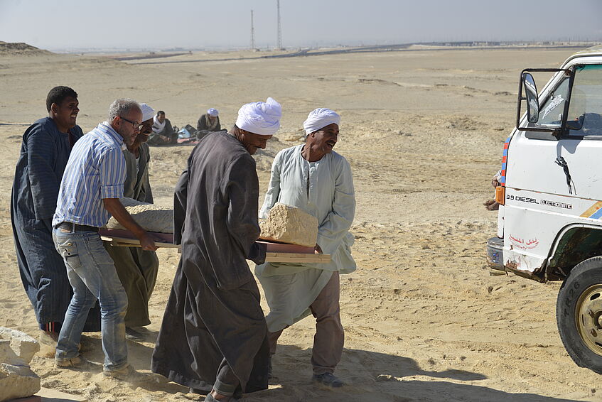
Fig. 18: A stone sarcophagus being made ready for transport to the storage
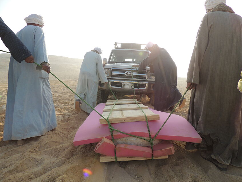
Fig. 19: A stone sarcophagus being made ready for transport to the storage
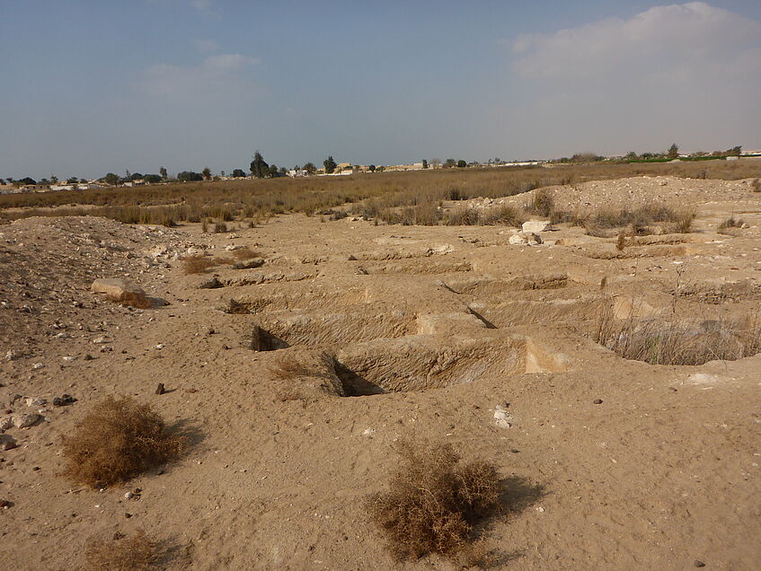
Fig. 20: Excavated tombs in the area of Malqata, where an Egyptian mission has worked
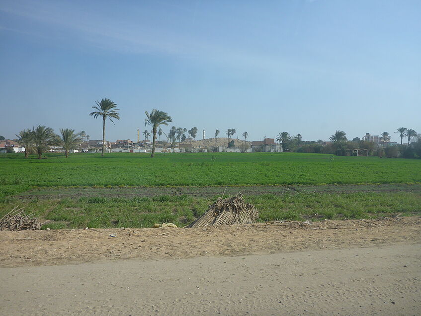
Fig. 21: One of the settlement kôms at al-Qays from the distance looking east
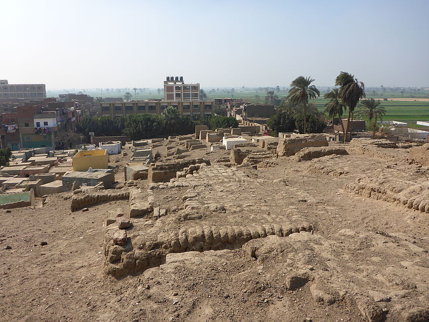
Fig. 22: Standing upon one of the settlement kôms at al-Qays looking south