Wadi el-Sheikh and Nazlet Awlad el-Sheikh
The area of Wadi el-Sheikh has been known to the scientific community at least since 1896 when Haywood W. Seton-Karr discovered evidence for ancient chert and flint mining activities. The wadi was subsequently visited by numerous other researchers, especially in the 1980s by Gerd Weisgerber of the German Mining Museum in Bochum. Weisgerber also assembled detailed information about the whereabouts of stone artefacts that Seton-Karr had collected and distributed all over various international museums and gained insights from first-hand observation of these mining activities, which he published in short articles. The area was visited repeatedly in recent times and is well recognized for its significance for Egyptian archaeology and chert mining although no systematic investigation has taken place until this mission resumed work here.
The information currently available suggests that mining activities stretched over a very large area along the course of the wadi and its tributaries, in particular upon the higher wadi terraces between 70 - 150 meters above sea level (Fig. 1). The area is characterized by a dense cover of chert (Figs. 2-3) of different colors and textures ranging from dense dark-brown chocolate to grey-brown, light brown, grey and cream colored material. There is evidence for human intervention in the form of extraction pits, trenches, shafts, spoil heaps, underground mining structures, retaining walls, shelter-like features and flint knapping sites suggesting that the raw material had been excavated and processed on the spot (Figs. 4-9). It appears as if there were different kinds of industries involved with variable modes and scales of production that probably stretch over much of the prehistoric and Pharaonic eras. There is evidence to assume that once the raw material had been extracted, the miners or knappers continued the production process and started to make relatively finished and well-retouched pre-forms on-site (Figs. 10-13). In some areas the miners seem to have engaged in the extraction and only primary processing of the raw material producing blanks, which they subsequently took to the settlements in the Nile Valley for further processing. One such settlement could possibly be the ancient town at nearby Kom el-Ahmar (Sharuna, Mission of the University of Tübingen) where Alfred Pawlik has studied the lithic industries and noted close connections with the wadi during the early 3rd Millennium B.C.E. Another such settlement could have been located near the village of Nazlet Awlad el-Sheikh (Fig. 17), where in the early 1960s Werner Kaiser had noted a small kôm with dense lithic deposits suggesting workshops. This site is also known for a number of Early Dynastic stone tombs which had been excavated in the early 20th century by Hermann Ranke and which would suggest that a small community with elites was resident in this area possibly specializing in the lithic industries.
From the size of the area and the density of archaeological remains of mining activities, it is obvious that the Wadi el-Sheikh once represented a major source for lithic raw material that catered for the stone tool industries across the entire Nile Valley over thousands of years (Figs. 14-16).
The Institute for Egyptology at the University of Vienna aims to engage in an intensive, long-term interdisciplinary research program in collaboration with the German Mining Museum in Bochum and the University of Virginia in order to systematically investigate this valuable archaeological source and to fully comprehend the chronology, technologies, extent and economic significance of these mining industries.
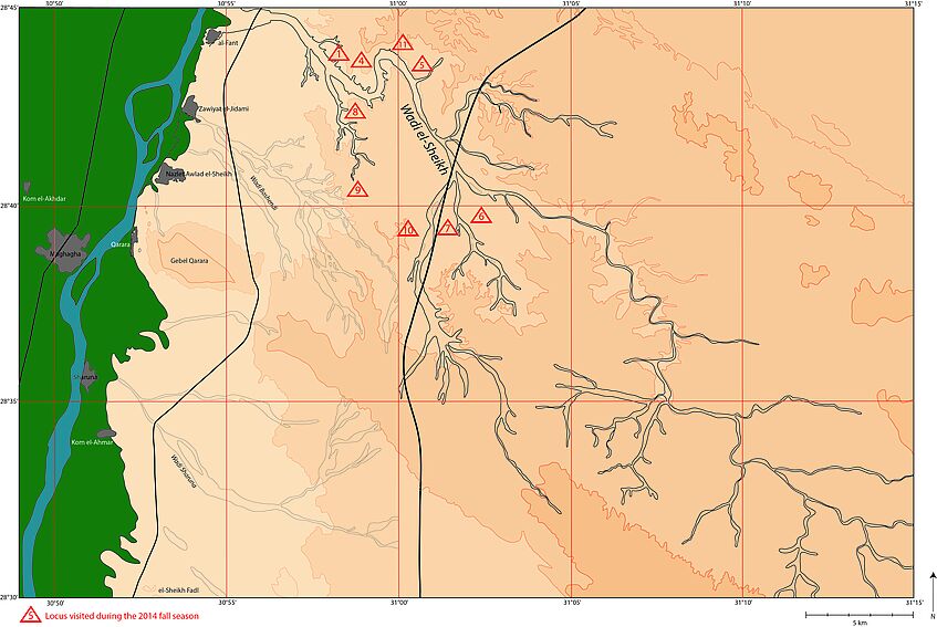
Fig. 1: Map of the Wadi el-Sheikh with loci visited by the Austrian mission in fall 2014
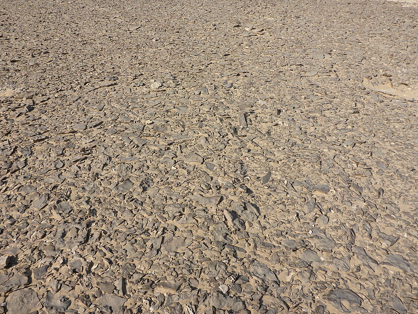
Fig. 2: Surface with dense chert cover
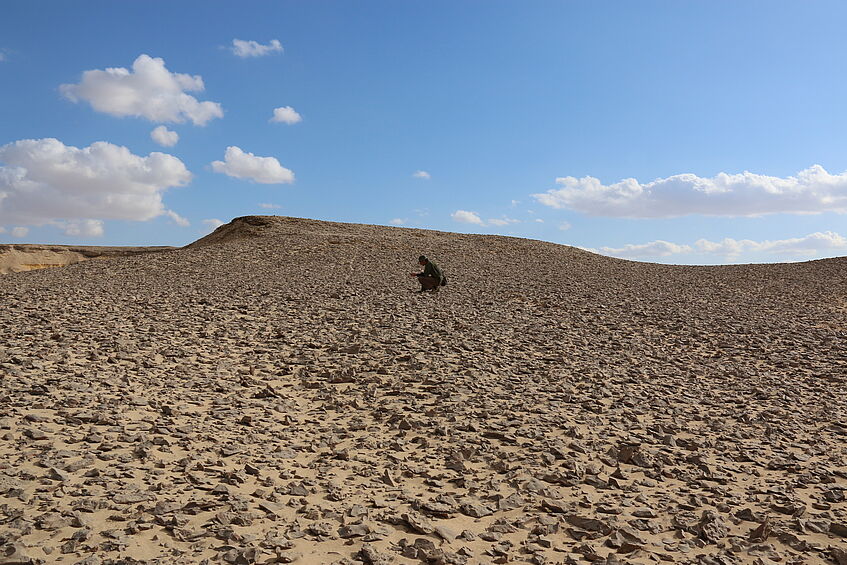
Fig. 3: Chert cover in Locus 1
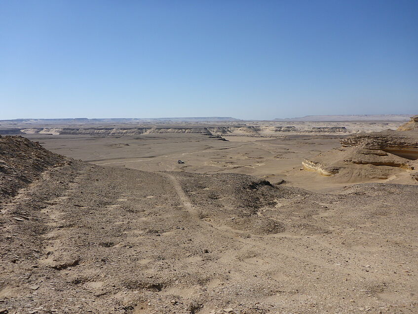
Fig. 4: Rows of pits in Locus 4
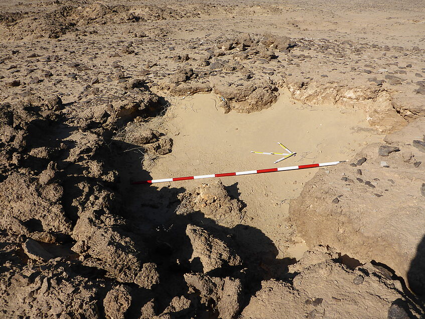
Fig. 5: Extraction pit in Locus 3
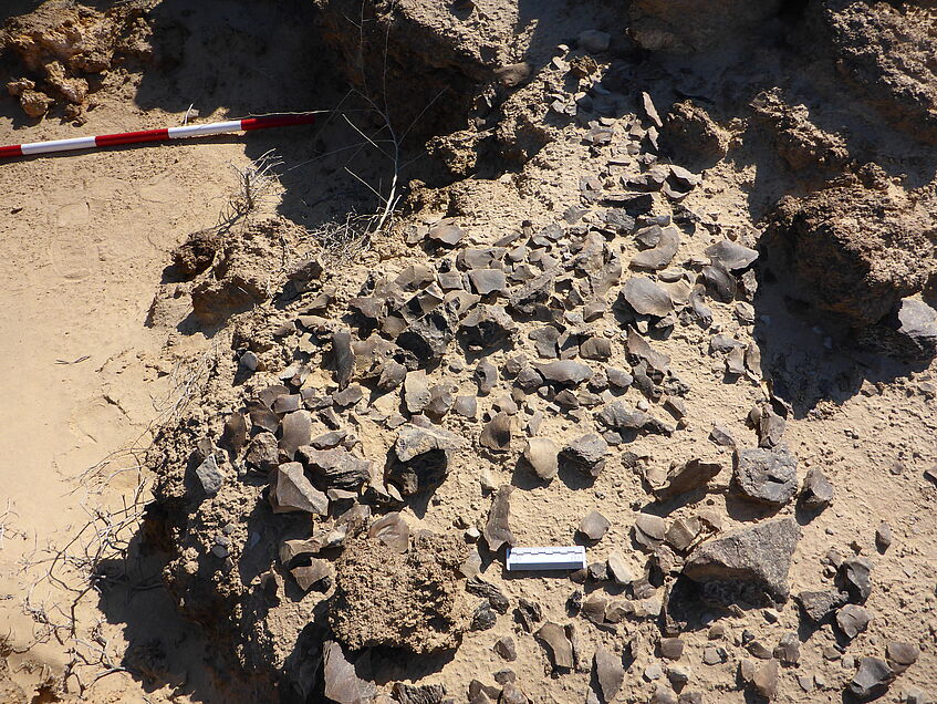
Fig. 6: Knapping site near the extraction pit in Locus 3
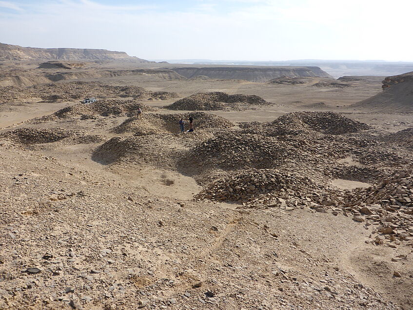
Fig. 7: Shafts and circular mounds of debris in
Locus 5
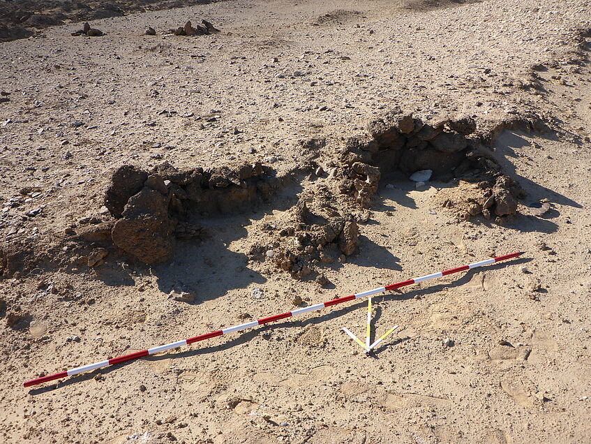
Fig. 8: Shelter-like structures in Locus 2
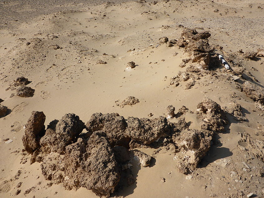
Fig. 9: Large rectangular structure in Locus 6
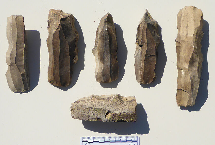
Fig. 10: Examples of chert cores from Locus 1
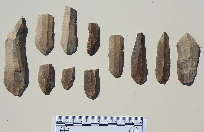
Fig. 11: Examples of chert blades and fragments from Locus 1
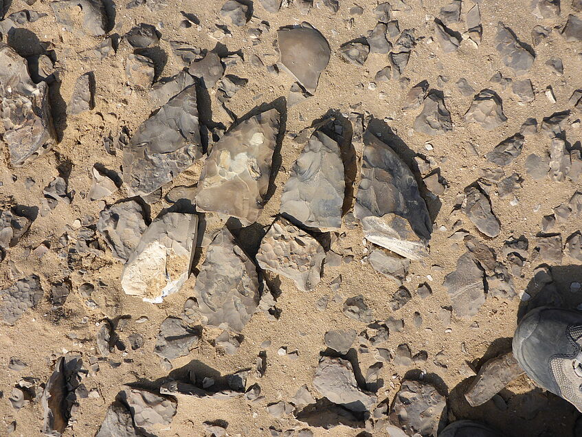
Fig. 12: Examples of chert bifaces in Locus 7
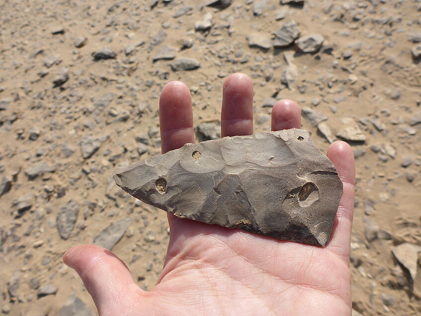
Fig. 13: Example of a bifacial tool pre-form in Locus 7
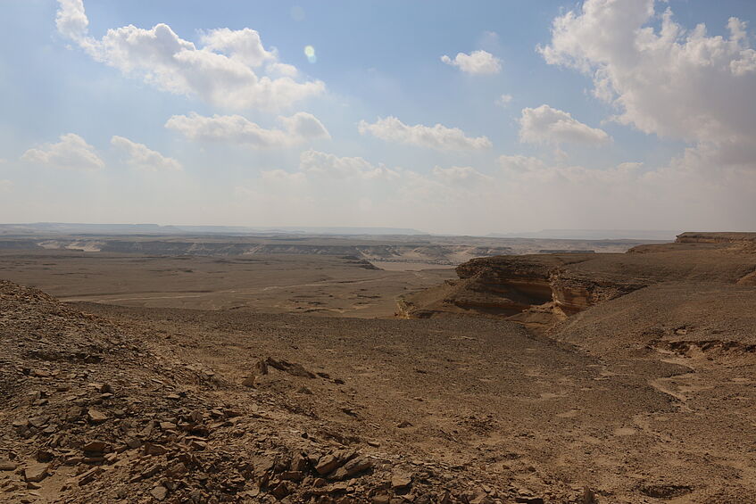
Fig. 14: View of the Wadi el-Sheikh in the area of Locus 4
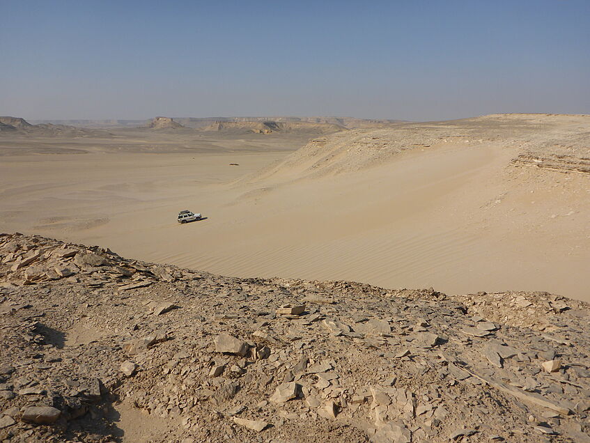
Fig. 15: View of the Wadi el-Sheikh in the area of Locus 6
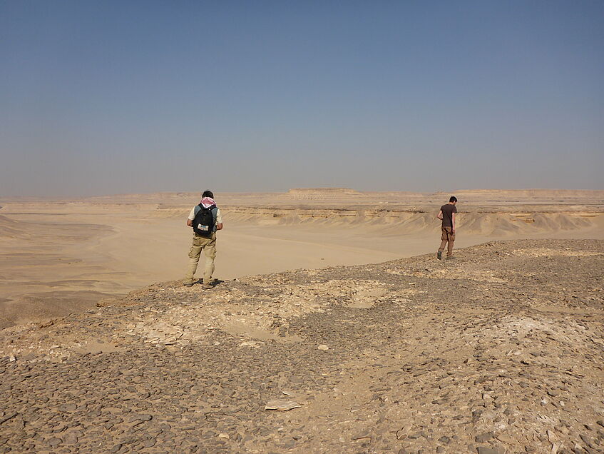
Fig. 16: Members of the mission during surface surveying in Locus 7
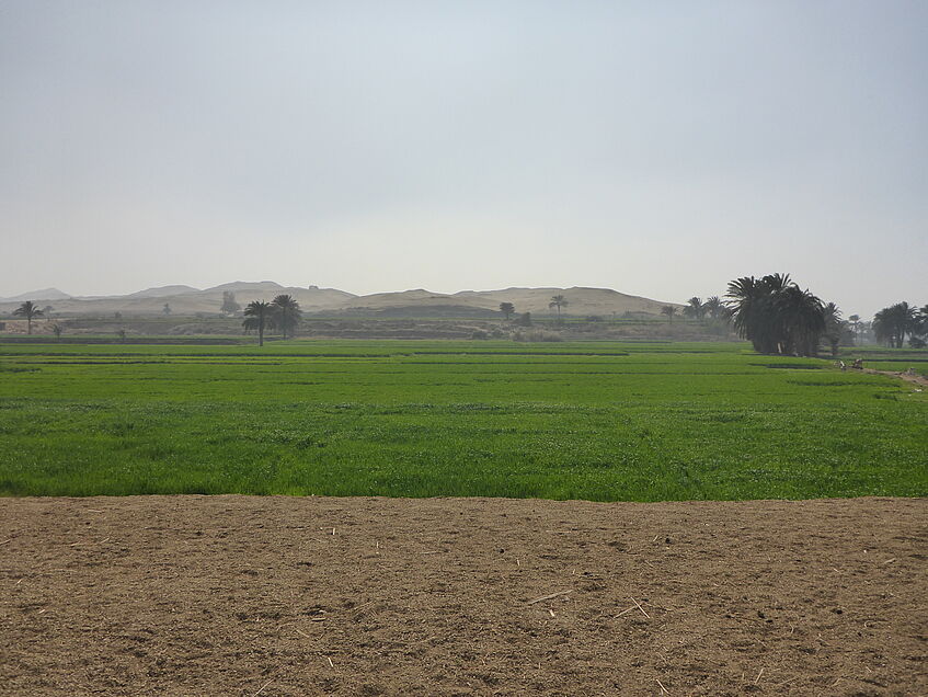
Fig. 17: The area near Nazlet Awlad el-Sheikh looking south